


3D Weather Globe & Atlas Deluxe
The award-winning 3D Weather Globe series adds a new dimension in this Deluxe Edition with 3D close-up views of the earth. You dont just look at the Andes mountains from above — now you can tilt the Earth view so you can fly through them. With realistic realtime weather in 3D, you can watch the first snow in the arctic, see the sun rise over the Hawaiian islands, safely observe a solar eclipse, or find your favorite constellation in the night sky. And of course youll get a complete weather package from dew point to wind chill factor, overlaid on the highest resolution maps ever created for the entire Earth — ten times more detailed than in the standard edition. Beautifully rendered 3D cloud cover is generated throughout the day from satellite data provided by CustomWeather, a professional weather service who provide feeds to Reuters and other news services.
See a Demo Movie of the Deluxe Edition in action: http://www.mackiev.com/globedeluxe/rain.html
With the Deluxe Edition of 3D Weather Globe & Atlas you can:
Be your own meteorologist.
- Track a hurricane and compare its path to one of the famous hurricanes of the past century.
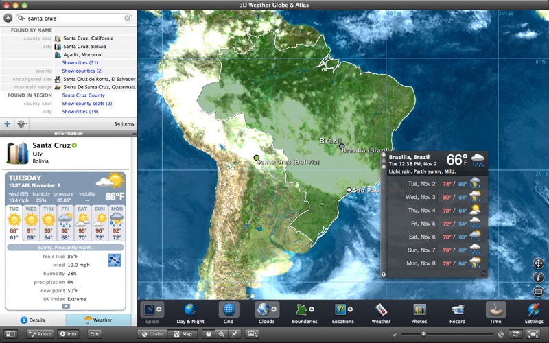
- Obtain realtime weather conditions in 60,000 locations or add your own.
- Get a weather map report for major cities just like on TV, but without having to wait for the six oclock news.
Explore planet Earth in 3D.
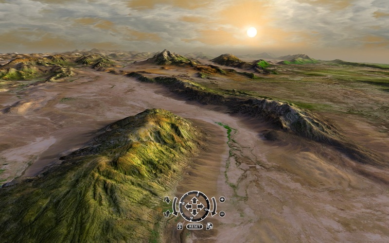
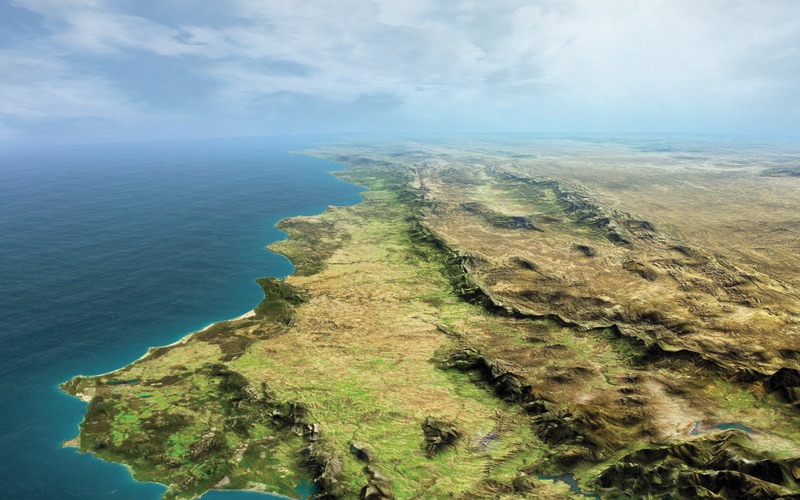
- Tilt the horizon to see mountains, canyons, and more in 3D relief.
- See 3D rain, lightening and snow falling in real time.
- Observe a variety of 3D cloud patterns in the sky as though you were there.
Learn about Outer Space.
- Get an accurate view of the moon, stars and planets.
- Turn on constellations and see their names in the night sky.
- Witness a solar eclipse with the accurate time slider.
Map your route or follow the explorers.
- Travel around the world on more 100 new famous routes from the first voyage of Columbus to Amelia Earharts last flight.
- Use the new Route Map organizer to catalog your trips.
- Attach photos and notes to places along the route of your trip.
Brush up on your geography.
- Locate landmarks, national parks, mountains, waterfalls, and much more.
- Locate capitals and look up their population, main attractions, and other interesting facts.
- Review background information on cities, states, and countries.
Share your adventures.
- Capture the globe and weather effects in motion as a Quicktime movie.
- Use the Fly Me There button to simulate a plane trip along a route you have traveled.
- Export and save any view of earth and beyond to set as your desktop or send by email.